SAIARD
Policy Reports
Choosing SAIARD as your policy advisor ensures that you benefit from our extensive experience, multidisciplinary expertise, and unwavering commitment to creating a sustainable and resilient future for South Asia.
Click to update
Start using this style on your WordPress sites and make your site more flexible.
- Land Use and Land Cover change in Mumbai (2012-2022) using GIS & Remote Sensing.
- A study on Creation of Green Corridors in Ranchi city with the help of GIS.
- Analysis Decadal Land Use and Land Cover (LULC) change of Barrackpore, West Bengal: A Geospatial Approach.
- Analyzing temporal Land Use Land Cover change and its impact on NDVI and LST using Geoinformatics technique in Barasat of North 24 Parganas district, West Bengal.
- Supervised Classification of some part of Nabarangapur district (Odissa).
- Land Used Land Covered in Nabarangapur, District of Odissa.
- Assessment of Land Use and Land Cover Changes in western Ghats – Wayanad District, Kerala.
- Land Use and Land Cover change and its impact on Land Surface Temperature: A Study of Siliguri Metropolitan City, West Bengal, India.
- Land Use and Land Cover Change Assessment Of Lower Ganga Watershed in Howrah District, West Bengal, Using Remote Sensing and GIS.
- Assessment of Eco-Sensitive Zone Using Geospatial Technology: A Case Study On Sundarbans.
- Effects of Different Urbanization Levels On Land Surface Temperature Change In The City Of Howrah and Kolkata.
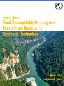
- The Morphometric Analysis of Sagileru River Basin, Andhra Pradesh, by using Geospatial Technology.
- Wetland Identification of Ajay River Basin.
- Water Quality assesment of Hooghly river near Howrah district.
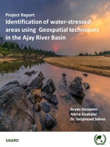
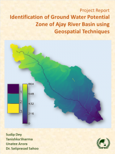
- Identification of ground water-potential using Geospatial techniques in the Ajoy River Basin.
- LULC Changes In The Lower Kankai River Basin: A Geospatial Approach
- Mapping Education & Health Facilities of Alipurduar District.
- Covid 19 Vaccination coverage of West Bengal, a District Level Analysis.
- Health Facilities (North Kolkata).
- Application of GIS Technology in Tourism Management of Kolkata, West Bengal.
- Urban Flood as Natural Hazard and its Management in Kolkata Municipal Corporation.
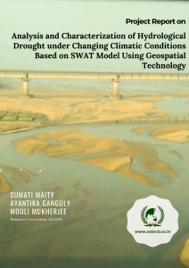
- Analysis and Characterization of Hydrological Drought under Changing Climatic Conditions Based on SWAT Model Using Geospatial Technology.
- Site suitability analysis of agricultural land through AHP and GIS technique A Case Study: East Kolkata Wetland.
- Site Suitability Evaluation for Agricultural Land Of Sikkim Using MCDM-Ahp Approach And Geospatial Techniques.
- Landslide resilience in North Bengal and Sikkim Himalayas: A geospatial Approach
- Role of Geospatial Technology for Biokart farming in Rural areas of Rangareddy District,Hyderabad as an emerging future prospective – A Case Study
- Potential of precision agriculture using geospatial technology in kalaburagi distrct, karanataka, india
- Geospatial Assessment of Coastal Resilience and Vulnerability along the Eastern Coast of India